
The member had witnessed a resident dumping a large quantity of grass clippings down one of our storm drains, and wanted to alert everyone to the danger that this kind of activity poses.
He's absolutely correct. This type of thing is a dangerous practice, and in my usual long-winded form, I will attempt to illustrate exactly why.
But before I do that, here's the short version, which was best summed up by our subdivision's developer several years ago after one of our annual meetings. He said (paraphrased), "If you folks ever allow those storm drains to get plugged up, you're going to get one hell of an awful surprise."
Short version or long version, that is the take-away: Don't plug the drains. Ever. Not even partially.
Let me elaborate as best I can.
On the issue of public education where subdivision flooding potential is concerned, we have three factors that are currently conspiring against us in a proverbial triple whammy:
(1) Greater Houston (irrespective of the rest of Texas) has been in drought for five years now. For this reason, what our area can throw at us in the way of flash floods is a distant memory for many people. And people whose memories fall into the "distant" category tend to be bad decision-makers.
 |
| A picture tells a thousand words, especially if some of those words are humorous. In this case, the picture was screengrabbed from Above the Aether which, in turn, apparently annotated it from their own Houston Chronicle grab (original URL no longer available, which is why bloggers tend to screen-grab commercial content for the purposes of commentary... it's because that content tends to annoyingly disappear). |
 |
| One of the aforementioned minor intervening events. News 92 FM source here. |
 |
| On this memorable day in recent history, it flooded so badly that we got trapped for six hours inside a for-sale house that we had gone to view prior to signing our Centerpointe build contract. Fortunately we were able to get our realtor's car above the rising waters before it was destroyed, whereas many of the street-parking neighbors were not so fortunate. Needless to say, this shocking experience rather soured us on that particular subdivision. I'll say more about this incident a bit further down in this post. |
 |
| Screengrabbed from this Houston Chronicle article. But before you proceed to faint dead away, read on. |
 |
| There we are near the bottom right corner. Most of the action is predictably happening near the top and top left corner, near Clear Creek. |
 |
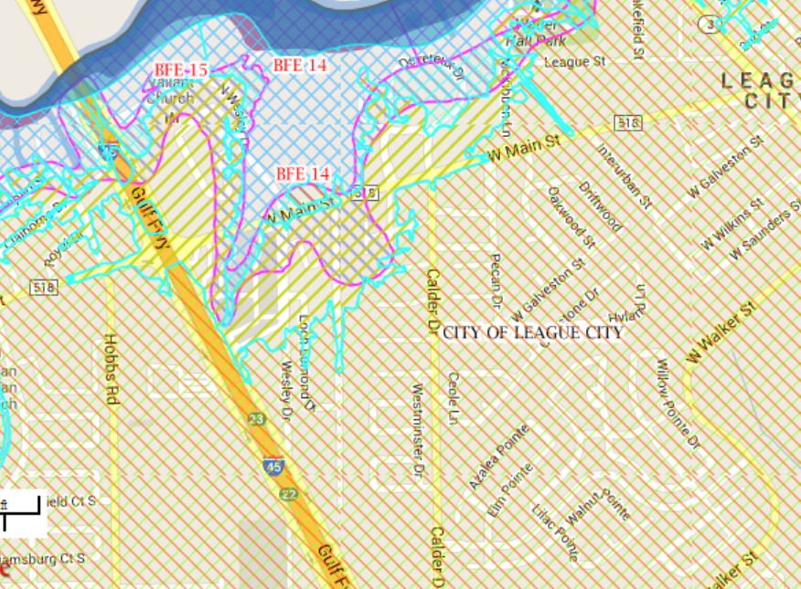
| I'm using some worm words in this description because these maps are annoyingly complex to the point where I doubt my own ability to comprehend them correctly. There are multiple overlapping stipple patterns depending on which layers you activate. |
 |
| ...but if I'm viewing this correctly, I think what they're saying is that we started out being Zone X... |

 |
| ...and we're going to remain Zone X after the new updates are finalized... |
 |
| But even Zone X is not without certain caveats. Screengrabbed from this FEMA site. |
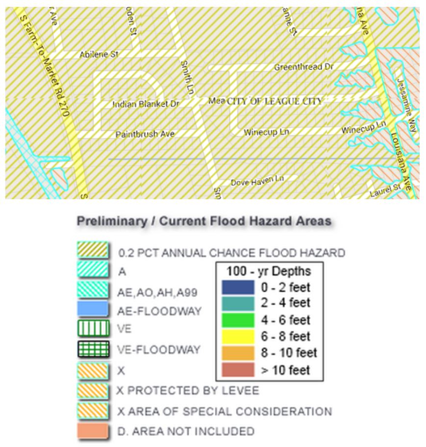 |
| BUT GUESS WHAT, DUDES?! Meadows does not appear to be in the 100-year flood zone either, and yet look again at my photo from 2009 (Meadows is located near the center of this screengrab). Screengrabs from RiskMap6 for Galveston County as it was presented in early September 2013. |
What's the moral of this story? Why did Meadows flood in 2009? Why did floodwaters within Meadows take hours to recede after the rain had stopped?
Once again, the internet irritates me because I can't link to a ready answer. At the time, there were allegations of plugged drainage conveyances, including one or more downstream conveyances that maybe were supposed to have been maintained by the City of League City. But the URLs have decayed to the point where I cannot find them now. As usual, citizen journalists persist where commercial journalists evaporate. You can watch raw footage of the flooding here, but I can't find the corresponding news reports.
The moral of that story is that EVERY greater Houston subdivision, without regard to FEMA designation, has the potential to flood IF there is a conspiracy of conditions that thwart the engineered drainage system within or downstream of the subdivision. And plugged drainage conveyances represent the worst possible scenario.
To further emphasize the potential we have here in Centerpointe, let's review a blog post I published in May of 2012, in which I humorously documented the fate of our two trash cans during an overnight rainstorm. Remember that both of these cans were full of trash and recyclables (i.e., heavy) at the time these images were captured, but they still proved to be no match for rising water:


That wasn't anywhere near the worst rainfall that we might have had, and look what it did! If you can look at those images above and still conclude that you don't need to voluntarily purchase flood insurance simply because FEMA says you've been mapped in Zone X, you need your head examined!!
Think about it. That particular heavy rainstorm hit on trash day. What would have happened if enough of our collective trash had gotten dumped out when rising water tipped over many peoples' cans? What if it had plugged up our drainage system? We all got VERY lucky on May 12, 2012, in that we stopped short of that conspiracy of circumstances that could easily have led to more extensive subdivision flooding.
Here is my best personal-opinion-based advice: Do not allow yourself to be without flood insurance anywhere on the upper Texas coast, regardless of what your property's official flood risk rating is.
Do not put grass clippings or any other solid material into our storm sewers, please. And maybe think about placing your trash cans in your driveway above the curb line if it looks like we might get overnight rain.
No comments:
Post a Comment
I'm forced to moderate comments because the spammers have become too much for me to keep up with. If you have a legitimate comment, I will post it promptly. Sorry for the inconvenience.