Showing posts with label History. Show all posts

Saturday, June 21, 2014

Ghost bike, ghost warehouses

I came upon two eerie sights this week near one of Houston's most iconic intersections.  This was the first one.

Where a single road is torn asunder, so too was a human being.  
It's a ghost bike.  It stands for this January incident in which a man was struck dead on the nearby bridge and thrown into the confluence of Brays and Buffalo Bayous.   
Tap to expand.  Ghost bike explainer screengrabbed from www.ghostbikes.org
The Houston ghost bike map confirms the identity of the person and the hit-and-run circumstances of his death.

I wonder why none of the deaths on the southeast side of town have been memorialized?

Also see Bike Houston for information on local efforts to reduce fatalities such as these.

Screengrabbed from Google. 
The other eerie sight was located almost within eye-shot of the Harrisburg ghost bike, and was this:
Those ghostly old warehouses that are sandwiched between the train tracks and the Houston Ship Channel are being torn down.  View from East Navigation Blvd., which is lined with live oak trees such as the one in the shadowy foreground here. You can see a yellow excavator behind the tank car, as the end of this warehouse is removed.    
One wall still standing.  I was sorta hoping that at least one Jackie Chan-type movie would be filmed here before these unusual warehouses met with their demise.  
What are (or were) these buildings?  It might be nice to learn something about them in the thirty-six remaining seconds that they have here on earth.  I know from casual conversations with folks that they are informally referred to alternately as "the old coffee warehouses" or "the old cotton warehouses" (I suspect the latter is closer to the truth), but I can find very little of their history on the internet, other than some nonspecific references and old aerial photos that include them.
One thing is clear - they are older than old, older than most other development in this area.  This is a public domain pic of the Houston Ship Channel (available via the UH archives). The warehouses are those solid masses roughly in the center of the photo.  That straight diagonal line you see to the left of the warehouses is East Navigation.  
Unfortunately, the curator hasn't done such a great job of estimating the age of that photo, narrowing it down to a period of 106 years (duh).  But with the north side of the channel still being partially forested (!!), the actual age could be closer to the first date than the second.  This reference has a similar photograph (partially view-able in Google Books) suggesting it was taken around 1930. 
Very roughly what the same view looks like today, showing full development all along Rio Buffalo.

Tilted, screengrabbed, and rotated from Google Earth.  
Warehouses (center of photo) as seen in a recent photo on Google Earth.  
Anyway, unless an investigative source such as @HoustoniaMag decides to look into it from a history / human interest perspective, we may never know the story of what is now crashing to the ground in a poof of ghostly dust.
Well, you could, but you wouldn't be very successful.

Chan had a talent for identifying movie scene locations that were as exotic as they were decrepit.  These old warehouses would certainly have fit that bill.  

Wednesday, December 25, 2013

The memory tree

Here's a creative and potentially meaningful idea for those of you, especially you younger people just starting out in your lives, who would like to develop a Christmas tree tradition that's a little deeper than the typical practice of simply buying a chopped-down tree and tossing a bunch of generic plastic and glass ornaments on it. 
It looks pretty and it's very traditional, but does a thing like this have any personal significance whatsoever??  Christmas is supposed to be a time of reflection, humble gratitude, and goodwill.  What do these brand new $2.99 fabric bows have to do with that? 

Screengrabbed from Wikimedia Commons
When I was a young woman beginning my post-graduate-school adult life in the early 1990's, I decided that my Christmas tree would be a memory tree, and that I would build it incrementally, year by year, just as I was building my life. 

There would be no cheap garlands and made-in-China shiny tinsel.  There would only be symbols of important rites of passage.  I myself would acquire only one new ornament each year, plus I would add gifts from other people that held personal significance. 

Once I settled on this idea, the obvious thought hit me:  Maybe I would live long enough to see my tree achieve decorative completion, or maybe I would not.  There was only one way to find out. 

A carved cat ornament, hand-made folk art from the deep American rural south, which I received as a gift.  This was my very first Christmas ornament. 

The other decision I made was that I would not kill a tree each year.  I bought a small Norfolk Island Pine, so that it could grow with me and the family I created.  By this time, we have cycled through a few of them, as they outgrew our house!!  One of those is now planted just outside our front window. 
That first Christmas, only that cat hung on my tree.  He was all alone there with his wide-eyed stare.  How could there be anything else on the tree??  I had not built my life yet.  To have a fleshed-out Christmas tree at that point would have felt false to me. 

But then came the relentless passage of time, with all of its extraordinary events.  Here's a small sample from the years that followed. 
From a year when Enron passed out hundred-dollar Swarovski ornaments as if they were candy canes.  And I went to one of those legendary Enron Christmas parties and I wandered around feeling completely helpless, wondering how on earth I would ever be capable of comprehending the essential mechanics of business, because money seemed to be raining down from the sky, and I couldn't for the life of me identify the source of it. 

And the rest, as they say, is history - not just mine, but every Houstonian's.  I stare at this ornament today and I am transported back to those moments of helplessness in the face of hollow grandeur.  And even now, I become as breathless as the now-lifeless corporation whence this expensive bit of glitter derived.     
A sterling silver ornament that was attached with a bow to the outside of one of the many baby shower gifts I received.  It is now tarnished, but to remove the tarnish would be to strip away some of the authenticity, because it's been a long time since I gave birth to that baby. 
A gift from a family member in 1999, because elephants never forget, and I am known for having a very good memory. 
More gifted folk art:  Santa on the half shell.  My extended family likes to support local microbusinesses just as I do. 
As my baby grew, so did the collection of ornamental art projects that she produced. 
A S'mores ornament which we selected to commemorate 2005, because we did a heck of a lot of camping that year!
From more than a decade ago, a twin ornament commemorating the last Christmas visit we had with a close friend's family before she died of cancer.  There's an inscription in the center (redacted here) and the other family has an identical ornament with the same inscription. 
Our chosen ornament for 2010, the year we brought our dog home!!  We had a heck of a time finding this one, and then we had to take a fine-point Sharpie marker to it in order to simulate her brindle coat.  But it's a pretty good resemblance, wouldn't you say? 
The answer for me was yes, I did, in fact, live long enough to see my tree completed - and completed with a richness that exceeded my wildest early-90's dreams. 

May your holiday be deeply meaningful to you according to whatever your personal traditions comprise.

Saturday, October 26, 2013

Dr. Ned and Fay Dudney Nature Center

What is this place, and who are the people it's named after? 

You've no doubt noticed the gate and the sign while driving down the stretch of FM 270 between Five Corners and NASA Road 1.
It's a 148-acre tract of largely wetlands adjacent to Clear Creek, roughly that elongated blob you see at photo center. 
League City's web entry describes a bit of the history of the property, but not much about its namesakes. 
Dr. Ned Dudney was a local physician who is considered to be one of the founding fathers of League City.  He was also instrumental in the formation of the hospital now known as Clear Lake Regional Medical Center, which holds a special place in my heart as it's where I gave birth to my daughter. 
In a nutshell.  Screengrabbed from this League City Historical Society newsletter
League City's current website is rather discordant, hosting this page which contains almost no information on the park, which in turn does not link to this page which does, but which is curiously anecdotal.  You'll notice that they make reference to the fact that this property was formerly called "the Davis tract".  That seems a propos of not much, until you consider that, at one time several years ago, League City had a loose ambition to acquire and link multiple wetland tracts into a larger system, of which this was only one tract, hence being called out as the so-and-so tract as distinct from the such-and-such tract.  My memories of those ambitions are both faint and incomplete because I was neither a League City resident nor was I extensively involved at the time.  But I do remember hearing about a larger plan along these lines. 
If you peruse Googlemaps, you'll see a number of analogous vacant tracts sandwiched between built-out areas and Clear Creek, including this tract north of the Clear Creek Village subdivision
There's not much that can be done with these tracts from a "developmental" standpoint.  They're situated partly within the Clear Creek floodway and almost entirely within the 100-year flood zone, and are seriously encumbered by their status as jurisdictional wetlands.  Therefore, the idea to obtain and connect a string of them as parkland made perfect sense. 
You're going to get a rude shock in a diversity of financial and logistical senses if you try to build something adjacent to the likes of this.  Pic taken from one of the Dudney Center's bird blinds.  Those are white pelicans in the background. 
Like I said, I don't know what happened to that original plan.  New Mayor, new Councilmembers, who knows??  If anyone knows, please email me a short-version summary and/or some links.  This issue has been tied up in the hike and bike trail plan, the evolution of which I'll need to address separately in a future post.  Meanwhile, let me leave you with a few non-spoiler pics I took at the Dudney center late yesterday afternoon.
I hadn't been to the place in a few years, and I had forgotten that it's a good place to walk dogs, which are permitted in the park as long as the waste and leash ordinances are observed. 
The main trail is wonderful - wide and paved in concrete, which makes it suitable for kids on tricycles, people in wheelchairs, parents pushing strollers, etc.  This one low section is finished as an elevated boardwalk. 
Yesterday afternoon was not the most peaceful time to take a walk, however, as Wings Over Houston was rehearsing in preparation of today's events!!
As usual, I was largely interested in macro photography.  The park contains quite the diversity of native and invasive plants.  It's adjacency to Clear Creek means that a lot of suburban seeds get washed into its boundaries and take root. 
Bumblebee on goldenrod.  Not to be confused with honey bees, the kind that gets Africanized, although they were certainly present, too. 
This guy above may be some species of Leschenaultia, which is apparently also known as a big black hairy fly (ya don't say!).  I don't know what they do for a living, but they were present in abundance. 

Sunday, September 22, 2013

Galveston ramble: Bishop's Palace and Moody Mansion

They're both worth seeing, but Bishop's Palace is more about art (in its architecture), and Moody Mansion is more about history (with its place in Galveston lore).  We are art people, and so we preferred the Palace. 
Rainy Saturday and scratch another one off the Bucket List.  I didn't feel like fighting Houston traffic in the rain, so we headed south down an empty freeway to the island.   My husband and I have both lived in greater Houston for a gazillion years but neither of us had seen this previously.  It's one of those things that fell into the "one day" category that we never got around to. 
Did I say art?!  What was this mason smoking?!  Many different unrelated styles and stones, and yet it all works together perfectly. 
We are also not very big on velvet rope, of which there is more at Moody Mansion, where the tour we took was closely led by a narrator instead of being self-guided and self-paced, as it was at the Palace.  If you have small children, the Palace is probably your better bet because they might get fidgety during the long but interesting Moody discourse. 

For all their wealth, the Moody family didn't make a huge spectacle of their living quarters.  The third floor of the mansion remains unfinished to this day because they reportedly never needed it. 

Note that you better buy your tickets early in the day for the Moody tour because it sells out. 
No interior photos to show you in this post, because photography was prohibited inside both places.  I could have spent another hour just examining the exteriors, the craftsmanship is so fascinating.
I'll go back one day for a closer look when the sun is out.  Yeah, "one day". 

Tuesday, June 18, 2013

Building Galveston

Every time I go to Galveston, I get a little bit depressed by its latent capacity for redevelopment, capacity which remains unrealized decade after decade. 
One of an uncountable number of beautiful old buildings boarded up. 
It contains a row of carved faces near the top, but they all look very sad. 
When I ask people why this languishing perpetuates, I've consistently gotten the standard pat answer over the past twenty years: "Galveston is controlled by a small number of wealthy families, and they don't want to see increased development because that would dilute their power and they'd lose their ability to control it."  I have no way of knowing how much truth there is to this, but that's the urban legend that tends to serve as an explanation.  Maybe someday, someone will investigate this and publish a proper analysis (hint, hint). 

Whatever the real story is, not even billionaire BOI George Mitchell can seem to truly breach it despite his phenomenal contributions over the years.  He's often credited with the famous quote "Any fool can make money in Houston, but it takes a genius to do it in Galveston", but he himself actually attributes that gem of a summation to one of his brothers

Anyway, it's a shame that Galveston doesn't achieve its potential.  It's a shame in the larger social context but it's also a bummer specifically for the several hundred thousand of us who live at this node, the center point between Houston and Galveston. 
Our subdivision's developer didn't pull our name out of thin air.  Sometimes I joke that our personal center of everything is in the exact middle of nowhere, but we literally are at the center of gravity of these two cities.  This is the sign at eastbound FM 518 and IH-45.  Our freeway exit (League City Parkway) is about six thousand feet south of here, which quite literally puts us in the middle.
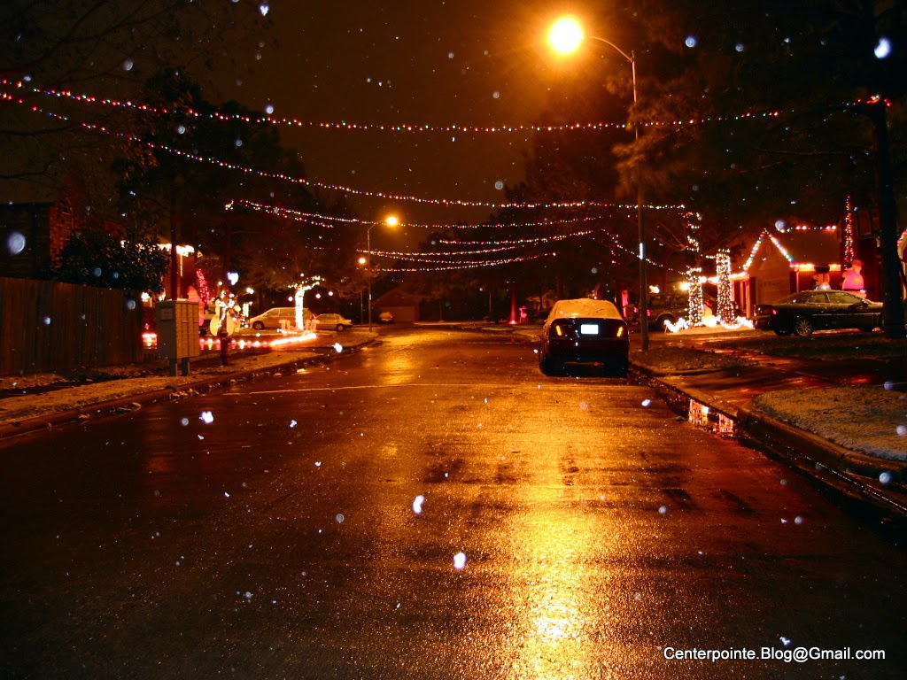
We Clear Lakers can go either north or south for some of our extra-territorial social recreation, but in the logistical sense, it's one hell of a lot easier to head south.  There are many non-working days where I just wish I could zip out for an hour or two without an epic traffic battle.  Unless there's a holiday or special event in Galveston, it's often easy to just fly down the road and be there quickly without wasting time and energy.  If instead I go to Houston, I'm usually exhausted by the freeway fight before I even get there. 

So I did this - I went to Galveston late Sunday afternoon after getting into a mood of ,"I just want to go for a simple walk and see some stuff"

Following our recent underwhelming ArtWalk experience, I started off around Postoffice Street, which was quite literally deserted.  I was the only patron in almost all of the stores and galleries I entered.  Not unexpectedly, most of them closed up shop by 5 p.m. on a beautiful weekend afternoon (another Galveston bonus: summertime temperatures are much cooler than in Houston).  No sense staying open if there's no one around. 

I then ambled a few blocks north to The Strand, which is where the action was - but why, I'm not entirely sure, because much of what's there seems to consist of trinket shops and places that sell ice cream and unhealthy sugary drinks. 

And of course the trinket shops are full of cheap Made-in-China clothing which is suitably oversized for fitting folks who tend to overindulge in unhealthy sugary drinks. 

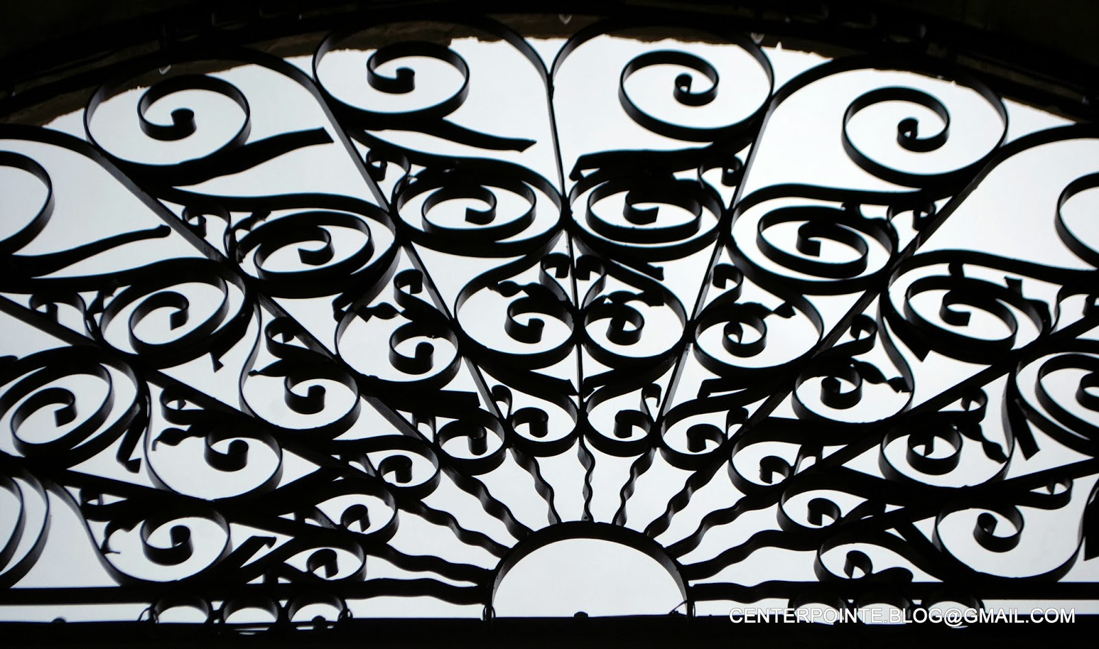
Nevertheless, I found some fun in one of my favorite facets of Galveston - the historical architecture - and so I thought I'd close this contemplative with some of that.  It might not be a good idea for a day laborer to set a single toe onto the public right of way in League City, but if you're a prosperous-looking middle-aged white woman carrying a gallery shopping bag, you can spend hours jay-walking like a disoriented stoner all though the City of Galveston and the only thing anyone will do in response to this is smile and nod.  I call this photo series below "Galveston buildings all taken from approximately the same street angle using a Lumia 928 cell phone", a title intended as a nerdy nod to "More songs about buildings and food".  I'm not even going to tell you what all of these buildings are, because sometimes it's better to simply shut up and look at the art without a lot of verbal details cluttering up the experience. 

Happy rambling, with or without an epic freeway battle.


Saturday, May 18, 2013

Smog smut

This may sound strange, but I've always hoped to get stuck in traffic at the top of the south Sam fly-overs to southbound IH-45.  What a photo op that would be!!  I actually have a friend who did get stuck at the very top.  They were driving home during the Christmas Eve 2004 snowstorm - yes, a "snowstorm" (a very mild one) in Houston. 
While I was running madly through the streets taking pics of Houston's first ever white Christmas, my buddy and his family were involuntarily pondering the scene from hundreds of feet in the air... 
...because, by the time they got to the top of the fly-over, the icing conditions were so bad (remember the old mantra "bridges freeze before roads") that all of the traffic simply halted and stayed put for like an hour and a half or something!!  None of the drivers wanted to risk tobogganing out of control down the other side of the fly-over, and who could blame them?  I can't find any published accounts of how tall that ramp is, but it's huge
This Texas Freeways site uses the term "Full Stack" to describe that array of ramps, and in the passionate language known only to highway enthusiasts, they note, "Sprawling, high flying ramps, symmetric. Could this be the perfect stack?"  Perfect for taking photos, supposing you have a legitimate reason to stop there. 
Anyway, nine years after that event, I finally got a quasi-chance yesterday when traffic slowed to stop-and-go.  I couldn't get out of my car, but at a dead stop, at least I could point my camera out the window and make an attempt to capture the impressive scene.
So close, and yet so far...
 But for the love of Pete, why was everything so blurry and hazy??  Because someone set Veracruz on fire, apparently.  Dang the luck - I finally get up there, and I'm enveloped in smog and smoke. 

Oh well.  Maybe it will snow again soon.  Not.
Better luck next time.